Geographic Data Science with PySAL and the pydata stack
This two-part tutorial will first provide participants with a gentle
introduction to Python for geospatial analysis, and an introduction to version
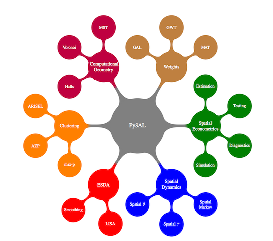
PySAL 1.11 and the related eco-system of libraries to facilitate common tasks
for Geographic Data Scientists. The first part will cover munging geo-data and
exploring relations over space. This includes importing data in different
formats (e.g. shapefile, GeoJSON), visualizing, combining and tidying them up
for analysis, and will use libraries such as pandas, geopandas, PySAL, or
rasterio. The second part will provide a gentle overview to demonstrate
several techniques that allow to extract geospatial insight from the data.
This includes spatial clustering and regression and point pattern analysis,
and will use libraries such as PySAL, scikit-learn, or clusterpy. A particular
emphasis will be set on presenting concepts through visualization, for which
libraries such as matplotlib, seaborn, and folium will be used.