Geographic Data Science
Local Spatial Autocorr.
Local Spatial Autocorr.
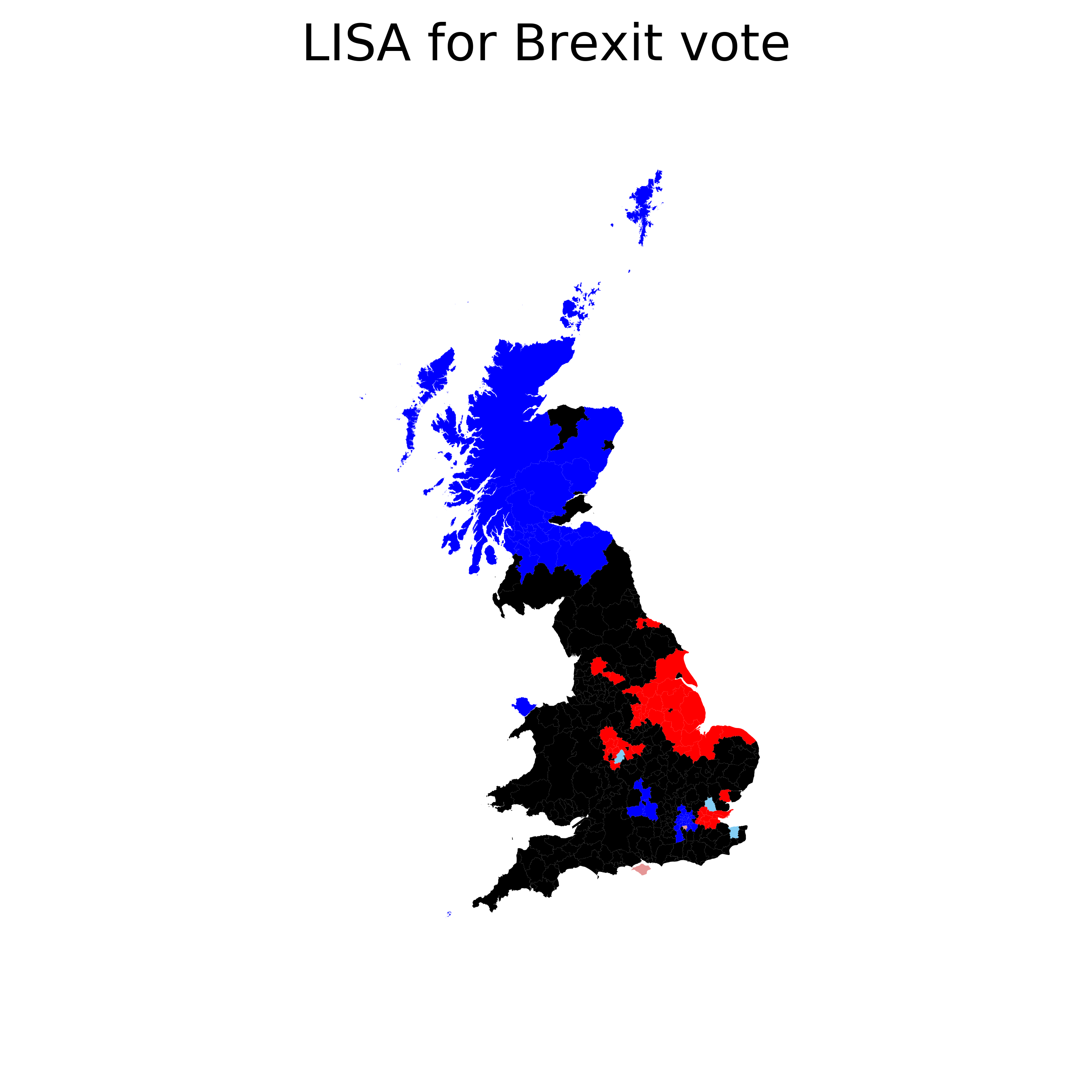
“Clusters”
Pockets of spatial instability
Portions of a map where values are correlated in a particularly strong and specific way
[High-High] + SA of high values (hotspots)
[Low-Low] + SA of low values (coldspots)
[High-Low] - SA (spatial outliers)
[Low-High] - SA (spatial outliers)
LISAs
Local Indicators of Spatial Association
Statistical tests for spatial cluster detection → Statistical significance
Compares the observed map with many randomly generated ones to see how likely it is to obtain the observed associations for each location

A course on Geographic Data Science by Dani Arribas-Bel is licensed under a Creative Commons Attribution-ShareAlike 4.0 International License.