Geographic Data Science
Global Spatial Autocorr.
Global Spatial Autocorr.
“Clustering”
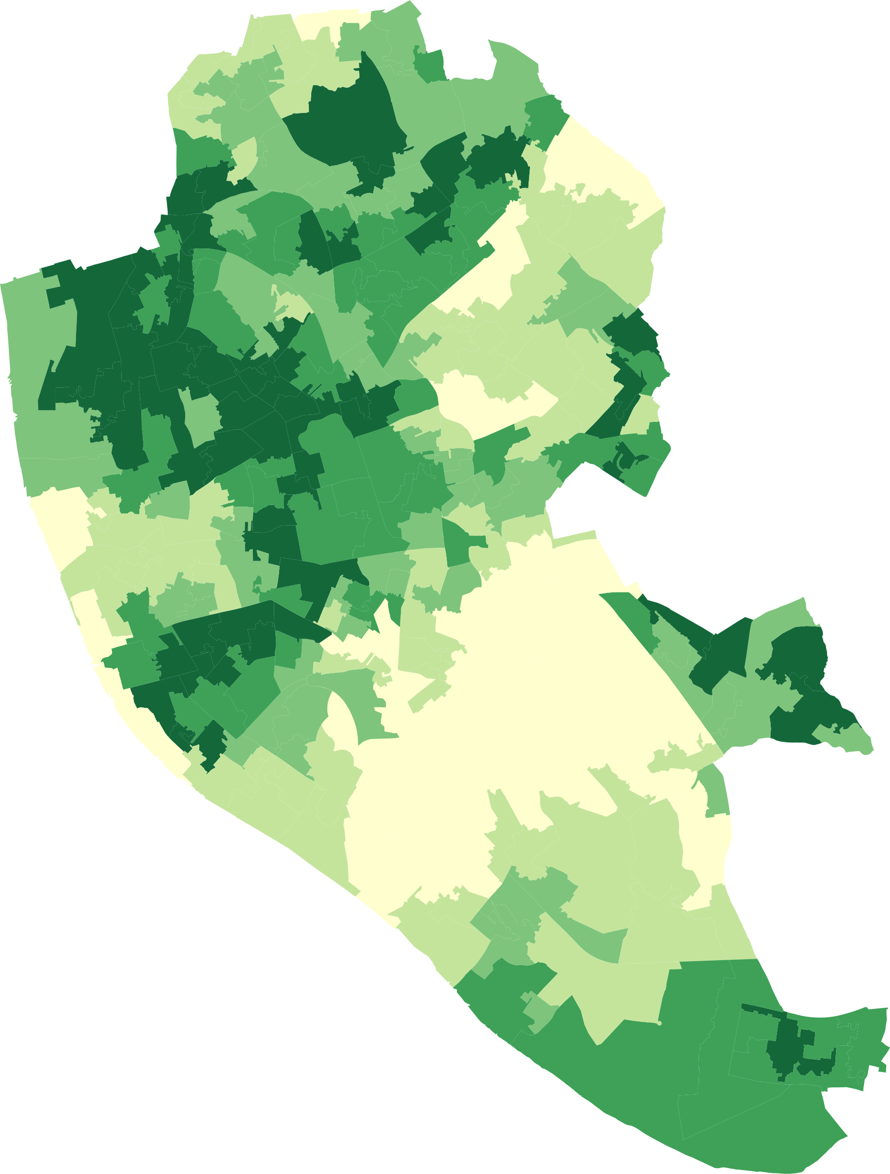
Overall trend where the distribution of values follows a particular pattern over space
[Positive] Similar values close to each other (high-high, low-low)
[Negative] Similar values far from each other (high-low)
How to measure it???
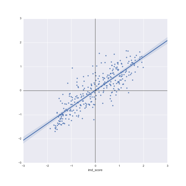
Moran Plot
- Graphical device that displays a variable on the horizontal axis against its spatial lag on the vertical one
- Variable and spatial weights matrix are preferably standardized
- Asssessment of the overall association between a variable in a given location and in its neighborhood
Moran’s I
Formal test of global spatial autocorrelation
Statistically identify the presence of clustering in a variable
Slope of the Moran plot
Inference based on how likely it is to obtain a map like observed from a purely random pattern

A course on Geographic Data Science by Dani Arribas-Bel is licensed under a Creative Commons Attribution-ShareAlike 4.0 International License.