Geographic Data Science - Lecture V
Space, formally
Dani Arribas-Bel
Today
- The need to represent space formally
- Spatial weights matrices
- What
- Why
- Types
- The spatial lag
- The Moran Plot
Space, formally
For a statistical method to be explicitly spatial, it needs to contain some representation of the geography, or spatial context
One of the most common ways is through Spatial Weights Matrices
- (Geo)Visualization: translating numbers into a (visual) language that the human brain "speaks better"
- Spatial Weights Matrices: translating geography into a (numerical) language that a computer "speaks better".
Core element in several spatial analysis techniques:
- Spatial autocorrelation
- Spatial clustering / geodemographics
- Spatial regression
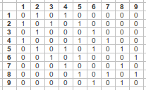
W as a formal representation of space
W
wii = 0 by convention
...What is a neighbor???
Types of W
A neighbor is "somebody" who is:
- Next door → Contiguity-based Ws
- Close → Distance-based Ws
- In the same "place" as us → Block weights
- ...
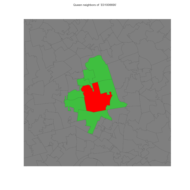
Contiguity-based weights
Sharing boundaries to any extent
- Rook
- Queen
- ...
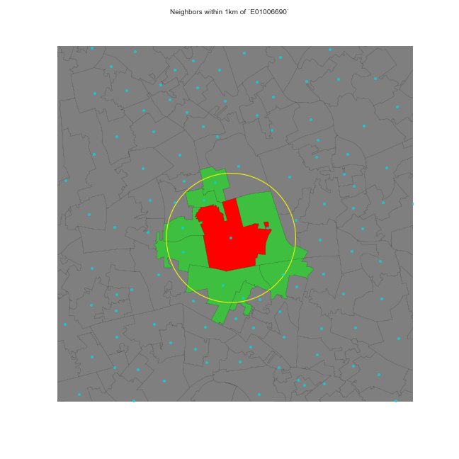
Distance-based weights
Weight is (inversely) proportional to distance between observations
- Inverse distance (threshold)
- KNN (fixed number of neighbors)
- ...
Block weights
Weights are assigned based on discretionary rules loosely related to geography
For example:
- LSOAs into MSOAs
- Post-codes within city boundaries
- Counties within states
- ...
Other types of weights
- Combinations of the above
- Kernel
- Statistically-derived
- ...
See Anselin & Rey (2014) for an in-detail discussion.
How much of a neighbor?
No neighbors receive zero weight: wij = 0
Neighbors, it depends, wij can be:
- One wij = 1 → Binary
Some proportion (0 < wij < 1, continuous) which can be a function of:
- Distance
- Strength of interaction (e.g. commuting flows, trade, etc.)
- ...
Choice of W
Should be based on and reflect the underlying channels of interaction for the question at hand.
Examples:
- Processes propagated by inmediate contact (e.g. disease contagion) → Contiguity weights
- Accessibility → Distance weights
- Effects of county differences in laws → Block weights
Do your own (contiguity) weights time!

Standardization
In some applications (e.g. spatial autocorrelation) it is common to standardize W
The most widely used standardization is row-based: divide every element by the sum of the row:
where wi· is the sum of a row.
The spatial lag
The spatial lag
Product of a spatial weights matrix W and a given variably Y
Ysl = WY
ysl − i = ∑jwijyj
- Measure that captures the behaviour of a variable in the neighborhood of a given observation i.
- If W is standardized, the spatial lag is the average value of the variable in the neighborhood
- Common way to introduce space formally in a statistical framework
Heavily used in both ESDA and spatial regression to delineate neighborhoods. Examples:
- Moran's I
- LISAs
- Spatial models (lag, error...)
Moran Plot
Moran Plot
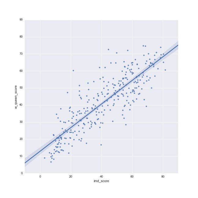
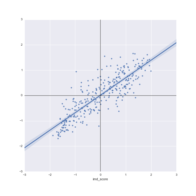
- Graphical device that displays a variable on the horizontal axis against its spatial lag on the vertical one
- Usually, variables are standardized ($\dfrac{y - mean(y)}{std(y)}$), which divides the space into quadrants
- Tool to start exploring spatial autocorrelation
Moran Plot
Recapitulation
- Spatial Weights matrices: matrix encapsulation of space
- Different types for different cases
- Useful in many contexts, like the spatial lag and Moran plot, but also many other things!

Geographic Data Science'17 - Lecture 5 by Dani Arribas-Bel is licensed under a Creative Commons Attribution-NonCommercial-ShareAlike 4.0 International License.