Geographic Data Science - Lecture II
(New) Spatial Data
Dani Arribas-Bel
"Yesterday"
Introduced the (geo-)data revolution
- What is it?
- Why now?
The need of (geo-)data science to make sense of it all
Today
- Traditional data: refresher
- New sources of spatial data
- Opportunities & Challenges
Good old spatial data
Good old spatial data
[source]
Good old spatial data (+)
Traditionally, datasets used in the (social) sciences are:
- Collected for the purpose --> carefully designed
- Detailed in information ("...rich profiles and portraits of the country...")
- High quality
Good old spatial data (-)
But also:
- Massive enterprises ("...every single person...) --> costly
- But coarse in resolution (to preserve pricacy they need to be aggregated)
- Slow: the more detailed, the less frequent they are available
Examples
- Decenial census (and census geographies)
- Longitudinal surveys
- Customly collected surveys, interviews, etc.
- Economic indicators
- ...
New sources of (spatial) data
New sources of (spatial) data
Tied into the (geo-)data revolution, new sources are appearing that are:
- ACCIDENTAL --> created for different purposes but available for analysis as a side effect
- Very diverse in nature, resolution, and detail but, potentially, much more detailed in both space and time
- Quality also varies greatly
Different ways to categorise them...
Lazer & Radford (2017)
- Digital Life: digital actions (Twitter, Facebook, WikiPedia...)
- Digital traces: record of digital actions (CDRs, metadata...)
- Digitalised life: nonintrinsically digital life in digital form (Government records, web...)
Arribas-Bel (2014)
Three levels, based on how they originate:
- [Bottom up] "Citizens as sensors"
- [Intermediate] Digital businesses/businesses going digital
- [Top down] Open Government Data
Citizens as sensors
- Technology has allowed widespread adoption of sensors (bands, smartphones, tablets...)
- (Almost) every aspect of human life is subject to leave a digital trace that can be collected, stored and analyzed
- Individuals become content/data creators (sensors, Goodchild, 2007)
- Why relevant for geographers? --> Most of it (80%?) has some form of spatial dimension
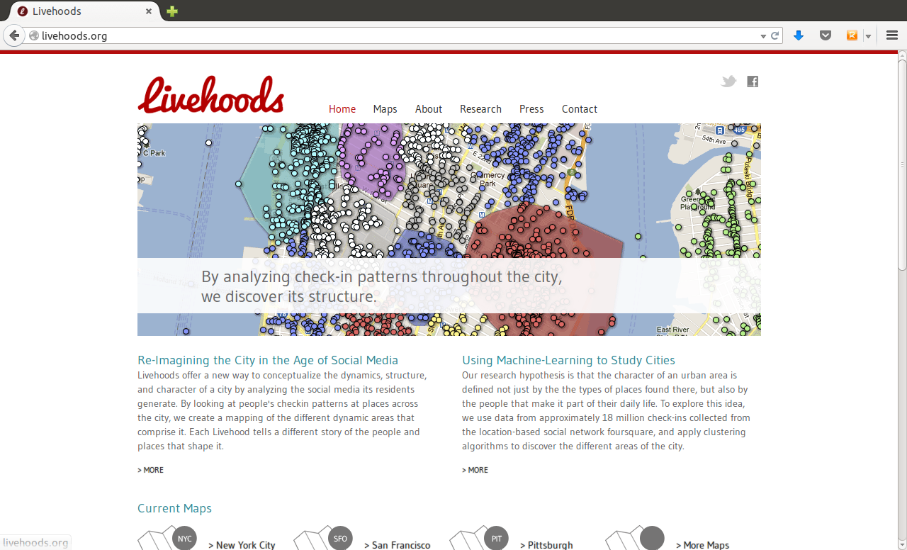
Example: Livehoods
Businesses moving online
- Many of the elements and parts of bussiness activities have been computerized in the last decades
- This implies, without any change in the final product or activity per se, a lot more digital data is "available" about their operations
- In addition, enirely new business activities have been created based on the new technologies ("internet natives")
- Much of these data can help researchers better understand how cities work
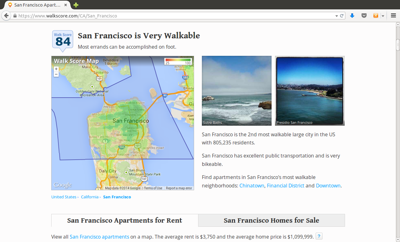
Example: Walkscore
Open data for open governments
Government institutions release (part of) their internal data in open format. Motivations (Shadbolt, 2010):
- Transparency and accountability
- Economic and social value
- Public service improvement
- Creation of new industries and jobs
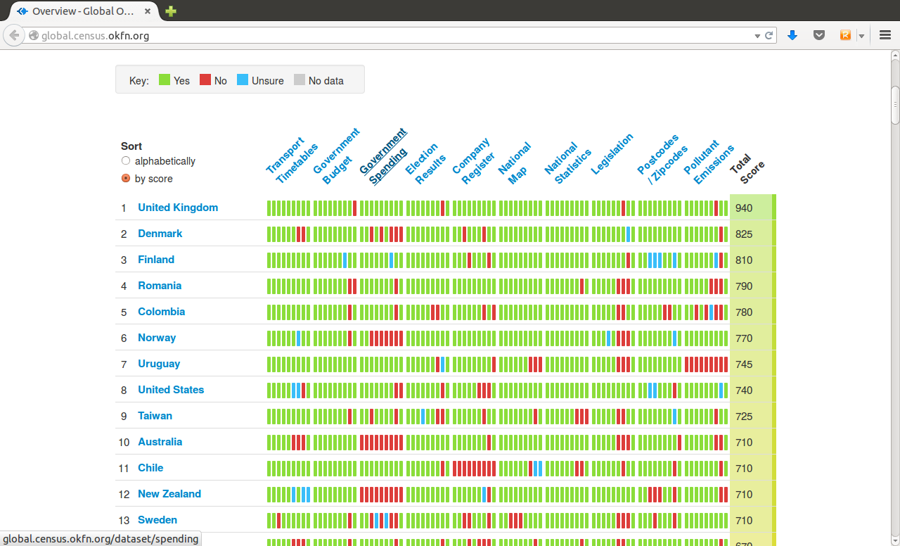
Global Open Data Index'14
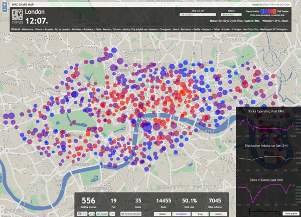
Example: BikeShare Map
Class Quiz
Class Quiz
In pairs, 2 minutes to discuss the origin of the following sources of (geo-)data:
- Geo-referenced tweets --> Bottom-up
- Land-registry house transaction values --> Open Government
- Google maps restaurant listing --> Digital businesses
- ONS Deprivation Indices --> Traditional (not accidental!)
- Liverpool bikeshare service station status --> Open Government Data
Opportunities & Challenges
Opportunities
From Lazer & Radford (2017):
- Massive, passive
- Nowcasting
- Data on social systems
- Natural and field experiments ("always-on" observatory of human behaviour)
- Making big data small
Challenges
- Bias
- Technical barriers to access
- The need of new methods
Bias
- Traditional data meet some quality standards (representativity, accuracy...)
- Because they're accidental, new data sources might not
- Researchers need to have extra care and put more thought into what conclusions they can reach from analyses with new sources of data
- In some cases, bias can run in favour of researchers, but this should never be taken for granted
Technical barriers to access
- Much of these data are available
- However, their accidental nature makes them not be directly available
Usually, a different set of skills is required to tap into their power
- Basic programming
- Computing literacy (understanding of the internet, APIs, databases...)
- Software savvy-ness (a.k.a. "go beyond Word and Excel")
(New) Methods
The nature of these data is not exactly the same as that of more traditional datasets. For example:
- Spatial aggregation: Polygons Vs. Points
- Temporal aggregation(frequency): Decadal Vs. Real-time
Some of this does not "play well" with techniques employed traditionally to analyze data in Geography.
(New) Methods

(New) Methods
To be able to extract as much insight as possible from these new sources of data --> borrow techniques from other disciplines, or even create new ones
Examples:
- Visualization
- Machine learning
But also others like bayesian inference, network science...
New + Old
Traditional data:
- High quality, detailed, and reliable
- Costly, coarse, and slow
Accidental data:
- Cheap, fine-grained, and fast
- Less reliable, harder to access, and potentially uninteresting
--> 1 + 1 > 2

Geographic Data Science'15 - Lecture 1 by Dani Arribas-Bel is licensed under a Creative Commons Attribution-NonCommercial-ShareAlike 4.0 International License.